The head of a Curtin spin-off company says that ground breaking technology he presented at this week’s Univation event will probably detect a larger gold deposit than that at the gigantic Kalgoorlie Super Pit.
HiSeis P/L CEO Peter Williams said the company had landed more than $2.3 million of contracts since its launch just 15 months ago.
“Overseas companies in particular have accepted the value proposition of what we’ve got,” Mr Williams said.
“With the technology we’ve developed, we are now able to work with mining companies to give them a much better understanding of their mine site geology using 3D seismic imaging techniques.
“In particular, we aim to provide them with the quickest, highest resolution, continuous 3D image of the geology within their mining holdings.”
Mr Williams said the technology would help companies fully appreciate, and strategically deploy, resources to best realise the assets in the ground over the lives of their mines.
“They also need to simultaneously appreciate any geological obstacles that would impede the realisation of this value, due to such concerns as rock failure,” he said.
“So we aim to provide a twin benefit of commercial optimisation and safety.
“No mine manager likes to be surprised.”
HiSeis has adapted high definition 3D seismic imaging techniques to hard rock mining, from such applications as petroleum engineering for offshore oil reservoirs.
Mr Williams said there were big differences between using seismic imaging in, say, offshore engineering compared to in hard rock terrains where seismic imaging was once problematic.
A $400,000 2D HiSeis seismic survey recently helped a major gold company identify subterranean faults and key elements such as structural traps for a mine planned in the US desert-state of Nevada.
The features were clearly identified at depths greater than 1000m underground.
“The company called us up after they had sponsored Curtin’s Centre for High-Definition Geophysics,” Mr Williams said.
“After four days of seismic surveying in the field and processing/imaging at night, they’d received a level of definition of the key geological elements in their model that they did not think feasible.”
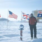
In the Arctic winter earlier this year, HiSeis helped mining company First Quantum produce a high definition 3D image of the geology of their open pit mine in Lapland.
The economics were such that a change in pit angle of just one degree could affect the value of the project by US$50m.
“There’s not too many companies in the world that have ever ‘shot seismic’ on land for mineral exploration in the middle of an Arctic winter,” Mr Williams said.
When integrated with more standard techniques and a database First Quantum had developed, the image gave a far greater appreciation of available resources in a fraction of the time taken with traditional drilling techniques.
“Having the best 3D image of the geology in the mine space is an invaluable strategic planning tool,” Mr Williams said.
“This technology can be used in a wide range of geological environments hosting different commodities – uranium, nickel, copper, lead, zinc, gold and even water.
“I think there will always be drilling but the most critical thing is we can help companies be smarter and quicker about where they drill.”
Mr Williams said that finding a larger Australian gold deposit than that at the nation’s biggest open cut mine, the Kalgoorlie Super Pit, was highly likely.
“We’re hoping to increase our clients’ chances of unearthing the next Mount Isa, Broken Hill or (Kalgoorlie) Golden Mile,” he said.
“All you need is the right eyes to be applied to the right place.
“The 3D high definition seismic surveying imaging provides those eyes.”
Closer to home, HiSeis is helping the Water Corporation better identify liquid resources for WA’s future.
“We’ve been assisting in modelling the three-dimensional geometry of the Perth Aquifer, and where it gets recharged from, for the past couple of years now,” Mr Williams said.
“Understanding the 3D geometry of aquifers and fault systems within aquifers is fundamental to effective planning of how to use the resource and how not to pollute it.
“Water is fundamental to human life, and understanding how to better manage this resource is extremely important, especially in times of climate change.”
Held on November 3 and 4, Univation showcased the brightest commercialisation prospects from WA’s four public universities.